Florida Flood Insurance Rate Map: Essential #1 Guide
Navigating Your Flood Risk: Understanding the Florida Flood Insurance Rate Map
For every Florida homeowner, from the Panhandle to the Keys, understanding flood risk isn’t just a good idea—it’s a financial and practical necessity. With thousands of miles of coastline, a low-lying topography, and the ever-present threat of hurricanes and tropical storms, the Sunshine State is uniquely vulnerable to flooding. Events like Hurricane Ian in 2022, which caused catastrophic storm surge and inland flooding, serve as a stark reminder that water is Florida’s most formidable natural force. The primary tool for understanding and quantifying this risk is the florida flood insurance rate map, commonly known as a FIRM.
A FIRM is an official map produced by the Federal Emergency Management Agency (FEMA) that illustrates a community’s flood zones, floodplain boundaries, and Base Flood Elevations (BFEs). These maps are the bedrock of floodplain management in the United States. They are critically important because they directly determine whether flood insurance is mandatory for properties with federally-backed mortgages, provide the data for setting insurance premiums, and establish the minimum standards for local building codes. For a homeowner, your property’s designation on a FIRM can influence its value, your ability to secure a loan, and the cost of protecting your investment.
This comprehensive guide will walk you through everything you need to know about the florida flood insurance rate map. We will explore what these maps are and why they are so vital, decode the various flood zone designations, and show you precisely how to locate your own property. We will also dig into the significant financial impacts of your flood zone, from insurance costs to building regulations, and discuss proactive steps you can take to mitigate your risk and potentially lower your premiums. Understanding your FIRM is the essential first step in building a resilient future for your Florida home.
Understanding the Blueprint: What is a Florida Flood Insurance Rate Map (FIRM)?
A florida flood insurance rate map (FIRM) is far more than just a line on a map; it is a detailed, data-driven community blueprint created by FEMA as a cornerstone of the National Flood Insurance Program (NFIP). Established by Congress in 1968, the NFIP aims to reduce the impact of flooding on private and public structures by providing affordable insurance and encouraging communities to adopt and enforce sound floodplain management regulations. The FIRM is the primary tool used to achieve these goals. Its purpose is to identify different levels of flood hazard areas and assess long-term flood risks, providing a scientific basis for policy and planning.
FIRMs are the culmination of extensive engineering studies. FEMA contractors perform detailed hydrologic and hydraulic analyses, considering factors like river flow, storm tides, rainfall data, and topographical surveys. This data is used to model future flood events and delineate the boundaries of floodplains. The maps specifically highlight Special Flood Hazard Areas (SFHAs), which are defined as having a 1% or greater chance of being inundated by floodwaters in any given year. This is often referred to as the “100-year flood,” a term that can be misleading. It does not mean a flood will happen only once every 100 years; rather, it signifies a 1% risk every single year. Over the life of a 30-year mortgage, a home in an SFHA has at least a 26% chance of experiencing a major flood, making these maps an indispensable resource for Florida property owners.
Why FIRMs are Critical for Florida Property Owners
For anyone owning or looking to buy property in Florida, a FIRM is a critical document with far-reaching implications:
- Property Value & Risk Assessment: A property’s flood zone is a material fact in any real estate transaction. It is a key component of any professional Flood Insurance Risk Assessment and can significantly influence a property’s marketability and value. Buyers need this information to understand their potential future costs and risks.
- Mandatory Insurance Requirements: This is perhaps the most direct impact. If your property is located within an SFHA and you have a mortgage from a federally regulated or insured lender, you are required by federal law to purchase and maintain flood insurance for the life of the loan.
- Community Planning & Building Safety: Local governments rely on FIRMs to enact and enforce building codes and zoning ordinances. These regulations dictate where and how new structures can be built to minimize future flood damage, protecting not only individual properties but the entire community’s safety and economic stability.
The Anatomy of a FIRM: Key Elements to Look For
When you view a florida flood insurance rate map, it can appear complex. Understanding its core components is key to interpreting it correctly:
- Map Panels & Community Info: FIRMs are often large and are therefore broken down into smaller sections called panels. Each panel has a unique number and identifies the community (e.g., City of St. Petersburg, Pinellas County) and its Community Identification Number (CID).
- Effective Date: This is one of the most important pieces of information on the map. It indicates the date on which the map became official for floodplain management and insurance rating purposes. Always ensure you are using the most current, effective FIRM, as older maps may be outdated.
- Legend: The map’s legend is your decoder ring. It explains the meaning of the various lines, symbols, shadings, and colors used on the map to represent flood zones, floodplain boundaries, and other features.
- Flood Zone Designations: These are the single- or multi-letter codes (e.g., A, AE, V, VE, X) that denote the specific category and level of flood risk for different areas on the map.
- Base Flood Elevation (BFE) Lines: In many high-risk zones, you will see wavy lines with associated numbers (e.g., EL 9). These are BFE lines, indicating the computed elevation to which floodwater is anticipated to rise during the base (1% annual chance) flood.
- Floodplain Boundaries: These are the lines that delineate the edges of the different flood zones, most importantly separating the high-risk SFHAs from moderate- and low-risk areas.
Cracking the Code: A Guide to Florida’s Flood Zone Designations
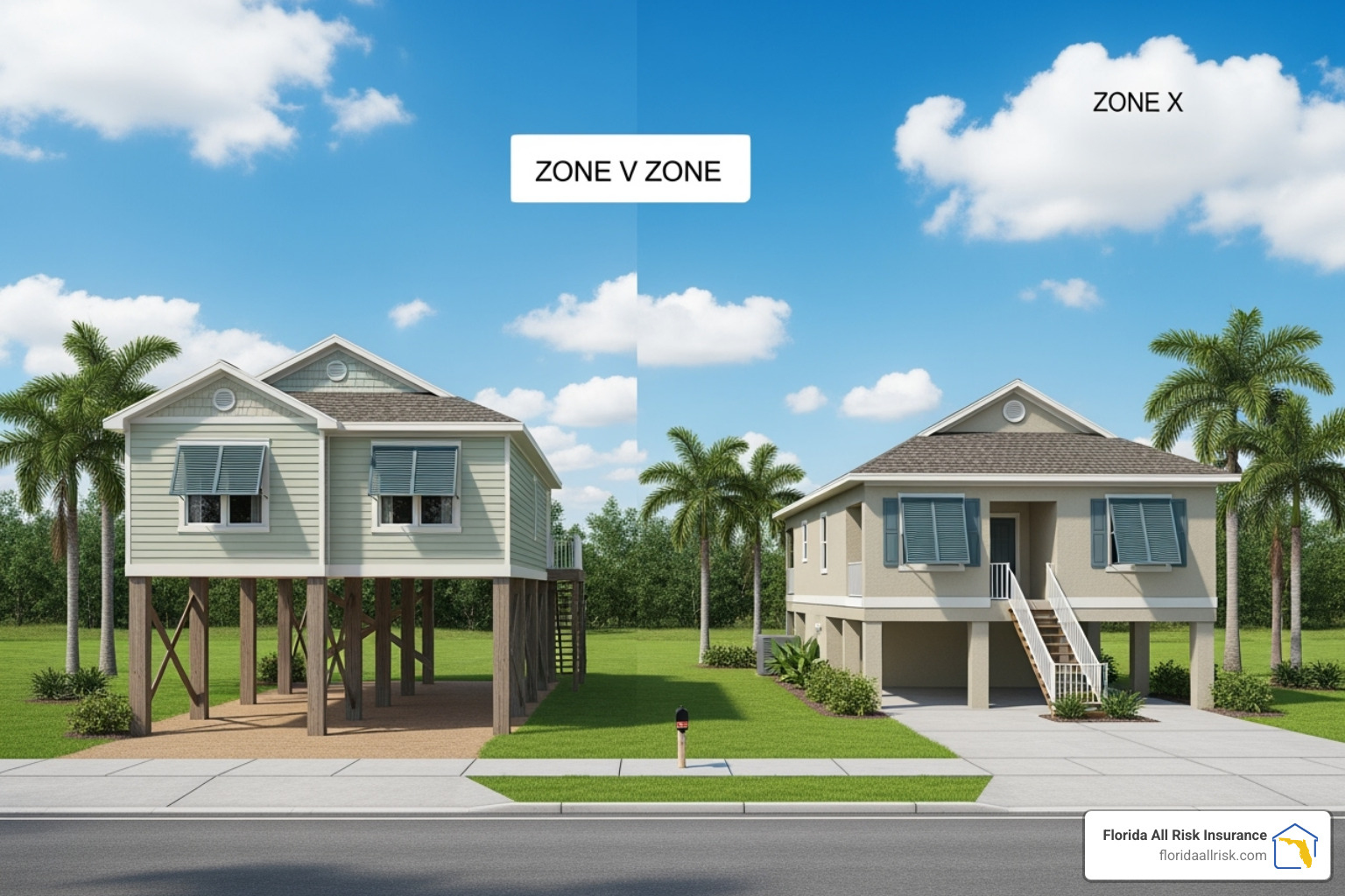
The letters on a florida flood insurance rate map are FEMA’s shorthand for communicating the type and severity of an area’s flood risk. Understanding this code is essential, as it directly determines insurance requirements, dictates building regulations, and informs mitigation strategies.
High-Risk Flood Zones: Special Flood Hazard Areas (SFHA)
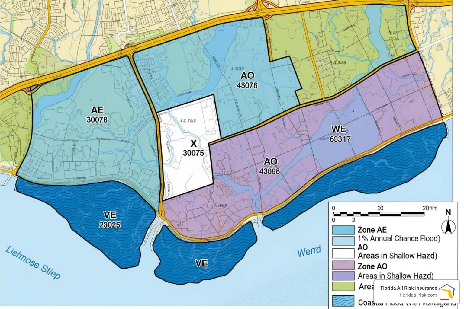
SFHAs represent the areas with the highest flood risk, defined as having a 1% or greater chance of flooding annually. These are the zones where flood insurance is typically mandatory for properties with federally-backed mortgages. They are broadly categorized as A zones or V zones.
- Zone A: This is a general designation for areas subject to the 1% annual chance flood. The key characteristic of a standard Zone A is that FEMA has not conducted the detailed engineering analysis required to determine Base Flood Elevations (BFEs). This can create challenges for construction and insurance rating, often requiring a property owner to obtain an Elevation Certificate to establish the building’s height relative to the estimated flood level.
- Zone AE: Like Zone A, this zone has a 1% annual chance of flooding. However, the ‘E’ signifies that BFEs have been determined and are shown on the map. This provides a clear, official benchmark for building elevation and allows for more precise insurance rating. If your property is in this zone, the question “Does Flood Zone AE Require Flood Insurance in Florida?” is almost always answered with a ‘yes’ if you have a mortgage.
- Zone AH: These are areas of shallow flooding, typically due to ponding, with an average depth of 1 to 3 feet. BFEs are determined for these zones.
- Zone AO: This zone also designates shallow flooding (1-3 feet), but it is typically caused by sheet flow on sloping terrain. The map will specify a flood depth rather than a BFE.
- Zone V / VE: These are the most hazardous flood zones, found in coastal areas. They not only face a 1% annual chance of inundation but are also subject to significant additional hazards from storm-induced wave action (velocity). Building codes in these zones are extremely strict, often requiring homes to be liftd on piles or columns. Zone VE is the designation used when BFEs have been determined. The risk is substantial: properties in V and VE zones have a 26% chance of flooding over a 30-year mortgage.
Moderate- to Low-Risk Flood Zones
It is a dangerous misconception that properties outside of SFHAs are “safe” from flooding. Flooding can and does happen anywhere it rains. In fact, FEMA reports that over 40% of all NFIP flood insurance claims occur in these moderate- to low-risk zones.
- Zone X (Shaded): This zone, sometimes labeled as Zone B, designates areas with a moderate flood risk. Specifically, it includes areas between the limits of the 1% annual chance flood and the 0.2% annual chance flood (the “500-year floodplain”). It also includes areas that would be in an SFHA but are protected by a certified levee or dam.
- Zone X (Unshaded): This zone, sometimes labeled as Zone C, represents areas of minimal flood hazard, determined to be outside the 0.2% annual chance floodplain. While the risk is lower, it is never zero. Given that 99% of U.S. counties have experienced a flood event, no area is truly risk-free. Flood insurance is highly recommended even in these zones, and the premiums are often very affordable. You can learn more about “How Much is Flood Insurance in Florida Zone X?“.
Undetermined Risk Areas
- Zone D: This designation is used for areas where flood hazards are possible but have not been analyzed or determined by FEMA. No flood insurance is mandated in Zone D, but lenders can still require it. The risk is unquantified, not absent, making precautionary flood insurance a prudent choice for property owners in these areas.
Pinpointing Your Risk: How to Find Your Property on a Florida Flood Insurance Rate Map

Identifying your property’s specific flood zone is a crucial step in assessing your risk and understanding your insurance and building requirements. Fortunately, there are several reliable, official sources available to Florida residents.
Using the FEMA Flood Map Service Center (MSC)
The definitive source for all official flood maps is the FEMA Flood Map Service Center. This online portal is free, publicly accessible, and contains the most accurate and up-to-date FIRM information for the entire country.
Here is a step-by-step guide to using the MSC:
- Steer to the Portal: Open your web browser and go to the official search page: Search By Address – FEMA Flood Map Service Center.
- Enter Your Full Address: In the search bar, type your complete property address, including the city, state, and zip code. Using the full address ensures the most precise location.
- Analyze the Dynamic Map: The system will generate a dynamic map centered on your address. Your property will be shown with an overlay of the flood zones. You can zoom in and out and pan around to see the surrounding area. The flood zone your property falls within will be clearly labeled (e.g., Zone AE, Zone X).
- Generate a FIRMette: For official documentation purposes (such as for a loan application or insurance quote), you can create a FIRMette. This is a free, printable, and official copy of a portion of the FIRM, complete with the map’s title block, legend, and scale. Look for a button or link labeled “Dynamic Map” or “View/Print FIRMette.” This document is invaluable for your records.
- Seek Help if Needed: If you have trouble interpreting the map or have specific questions, the MSC provides resources to help. You can Contact a map specialist directly through the portal for expert assistance.
Accessing Local Florida Flood Insurance Rate Map Resources
While the FEMA MSC is the official source, many Florida counties and municipalities offer their own GIS (Geographic Information System) mapping tools. These local portals can be more user-friendly and often integrate flood map data with other important property information, such as zoning, parcel lines, and aerial imagery.
- County-Specific Tools: For example, Lee County provides a very helpful Find My Flood Zone tool for its residents. Similarly, counties like Miami-Dade, Broward, and Pinellas have robust GIS websites. A simple web search for “[Your County Name] flood zone map” will typically lead you to the right resource.
- Local Floodplain Administrator: This is one of your most valuable local resources. The floodplain administrator is a city or county official, usually located in the planning, zoning, or building department. They are experts on the local FIRM, pending map changes, and the specific building ordinances that apply in your community. They can provide official determinations and guidance custom to your property.
By combining the official data from FEMA with the localized expertise of your county or city, you can get the most complete and accurate picture of your flood risk.
The Financial Impact: How FIRMs Influence Insurance, Building Codes, and Premiums
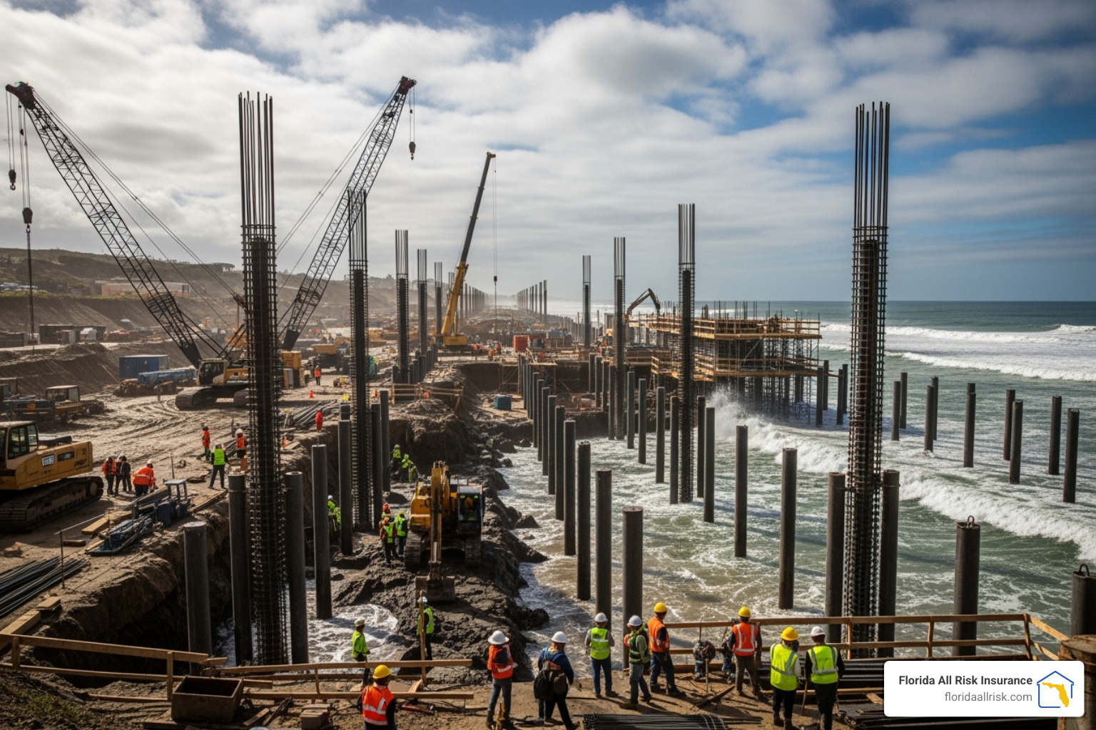
A florida flood insurance rate map is not an abstract document; it has direct and significant financial consequences for property owners. Your designated flood zone is a primary driver of insurance costs, a guide for millions of dollars in construction and development, and a key factor in your property’s long-term value. Understanding this connection is essential for sound financial planning.
Is Flood Insurance Mandatory in Florida?
The answer depends on your flood zone and your mortgage status. If your home is located in a Special Flood Hazard Area (SFHA)—any zone beginning with A or V—and you have a mortgage from a federally regulated or insured lender, then federal law mandates that you must purchase and maintain flood insurance. This is not optional. Lenders will track compliance and can “force-place” a policy at a much higher cost if you let your coverage lapse. For a complete overview, see our guide on Flood Insurance Requirements Florida.
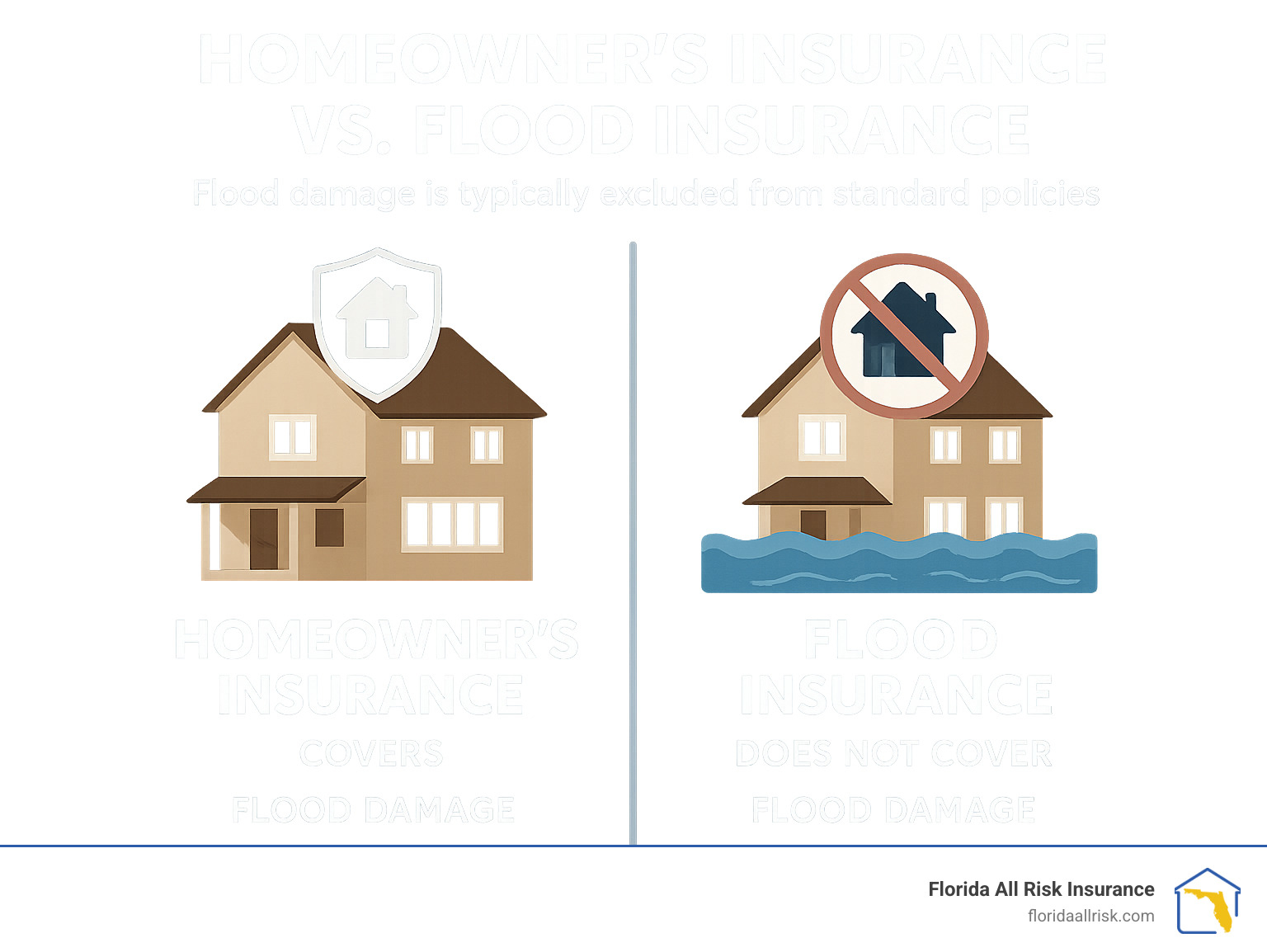
However, the mandatory requirement should not be the only consideration. Standard homeowners insurance policies explicitly exclude damage from flooding. With over 40% of NFIP claims coming from outside high-risk SFHAs and Florida’s susceptibility to widespread flooding from heavy rainfall, every property owner faces some level of risk. This is why most insurance advisors and emergency management officials strongly recommend coverage for all properties. The critical question isn’t just whether you’re required to have it, but “Does Everyone in Florida Need Flood Insurance?“
Building Codes, Development, and the 50% Rule
FIRMs are the foundation for local floodplain management ordinances, which dictate how structures must be built to resist flood damage:
- Elevation Requirements: In SFHAs, new construction and substantially improved structures must have their lowest floor liftd to or above the Base Flood Elevation (BFE). This is the single most effective way to reduce flood damage.
- Foundation Design: In coastal high-hazard V zones, regulations are even stricter. Foundations must be open (e.g., on piles or columns) to allow storm surge and waves to pass through without destroying the structure.
- Flood-Resistant Materials: Any portion of a building below the BFE must be constructed with flood-damage-resistant materials, such as concrete block, steel, or pressure-treated lumber, that can withstand direct contact with water.
- The “50% Rule”: This is a critical and often misunderstood regulation. If a structure in an SFHA is “substantially damaged” or “substantially improved”—meaning the cost of repairs or improvements equals or exceeds 50% of the building’s market value—the entire structure must be brought into full compliance with current floodplain standards. This often means elevating the entire house, a very costly undertaking. For example, if a home with a market value of $500,000 sustains $260,000 in hurricane damage, the 50% rule is triggered, and the owner must lift the home to the current BFE during repairs.
How a Florida Flood Insurance Rate Map Update Can Change Everything
FEMA periodically revises FIRMs to reflect changes in topography, new development, and improved scientific modeling. When a map is updated, your property could be re-designated. Being moved into an SFHA can suddenly trigger a mandatory insurance requirement and higher premiums. Conversely, being mapped into a lower-risk zone can bring financial relief.
To mitigate the financial shock of being mapped into a higher-risk zone, the NFIP offers specific rating options:
- Grandfathering: This allows property owners who have maintained continuous flood insurance coverage to keep their previous, more favorable flood zone or BFE for rating purposes after a map change.
- Newly Mapped Discount: For properties newly identified to be in an SFHA, this program provides a premium discount for the first year, which then phases out over subsequent years. To be eligible, a policy must be purchased within 12 months of the map revision date. You can check if your community has a flood map update underway on FEMA’s website.
Taking Control: Changing Your Flood Zone and Mitigating Risk
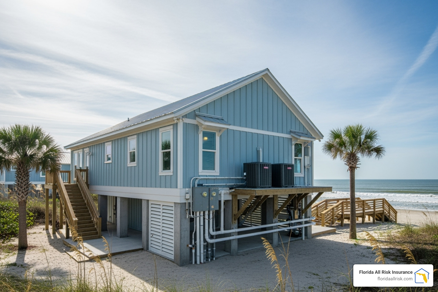
While a florida flood insurance rate map establishes your property’s official flood risk, you are not powerless. Homeowners have several avenues to challenge an incorrect designation, and more importantly, to physically mitigate their property’s vulnerability, which can lead to a safer home and lower insurance costs.
Challenging Your Flood Zone: The Letter of Map Change (LOMC)
If you have evidence that your property has been incorrectly mapped into a Special Flood Hazard Area (SFHA), you can petition FEMA to officially change its designation. This is done through a process called a Letter of Map Change (LOMC). There are two primary types:
- Letter of Map Amendment (LOMA): This is used when a property owner believes their specific parcel or structure is on naturally high ground and is incorrectly shown within the SFHA. The key piece of evidence is typically an Elevation Certificate, prepared by a licensed surveyor, which proves that the lowest adjacent grade (the ground level) of the property is at or above the Base Flood Elevation (BFE).
- Letter of Map Revision (LOMR): This is used when a property has been physically liftd by the placement of engineered fill. A LOMR request is more complex and requires certified engineering data to show that the filled land meets FEMA standards and lifts the structure above the BFE.
A successful LOMC application can officially remove the property from the SFHA, which in turn removes the federal mandatory flood insurance requirement. This can result in significant premium savings. You can begin the process through FEMA’s Online LOMC application.
Effective Flood Mitigation Strategies to Lower Risk and Cost
Even if your property is correctly located in an SFHA, you can take physical steps to make your home more resilient and potentially earn significant discounts on your flood insurance premiums.
- Lift Utilities: Relocate critical mechanical equipment—such as HVAC units, water heaters, and electrical panels—to a higher floor or an liftd platform above the anticipated flood level.
- Install Flood Vents: For enclosed foundation areas like garages or crawlspaces, installing FEMA-compliant flood vents is crucial. These vents allow floodwater to flow in and out, equalizing the immense hydrostatic pressure that can otherwise cause foundation walls to collapse.
- Use Flood-Resistant Materials: When remodeling or repairing areas below the BFE, use materials that can withstand water damage, such as tile, concrete, pressure-treated wood, and paperless drywall.
- Lift the Structure: The most comprehensive (and expensive) mitigation strategy is to lift the entire home on piers, piles, or a new, raised foundation so that the lowest living floor is above the BFE.
- Improve Lot Drainage: Simple landscaping, such as grading your yard to slope away from the house and using swales or French drains, can help direct rainwater away from your foundation.
These upgrades not only protect your property but can also lead to lower insurance costs, especially in communities that participate in the Community Rating System (CRS). The CRS is a voluntary FEMA program that rewards communities for adopting higher floodplain management standards than the minimum NFIP requirements. Florida is a leading state in CRS participation. Residents in these communities receive discounts on their flood insurance premiums ranging from 5% to 45%, depending on the community’s rating. Your mitigation efforts can contribute to a better rating and a lower premium. For cost-benefit examples, see “How Much Does Flood Insurance Cost in Florida?“.
Your Flood Risk Toolkit: Official Resources and Assistance for Floridians
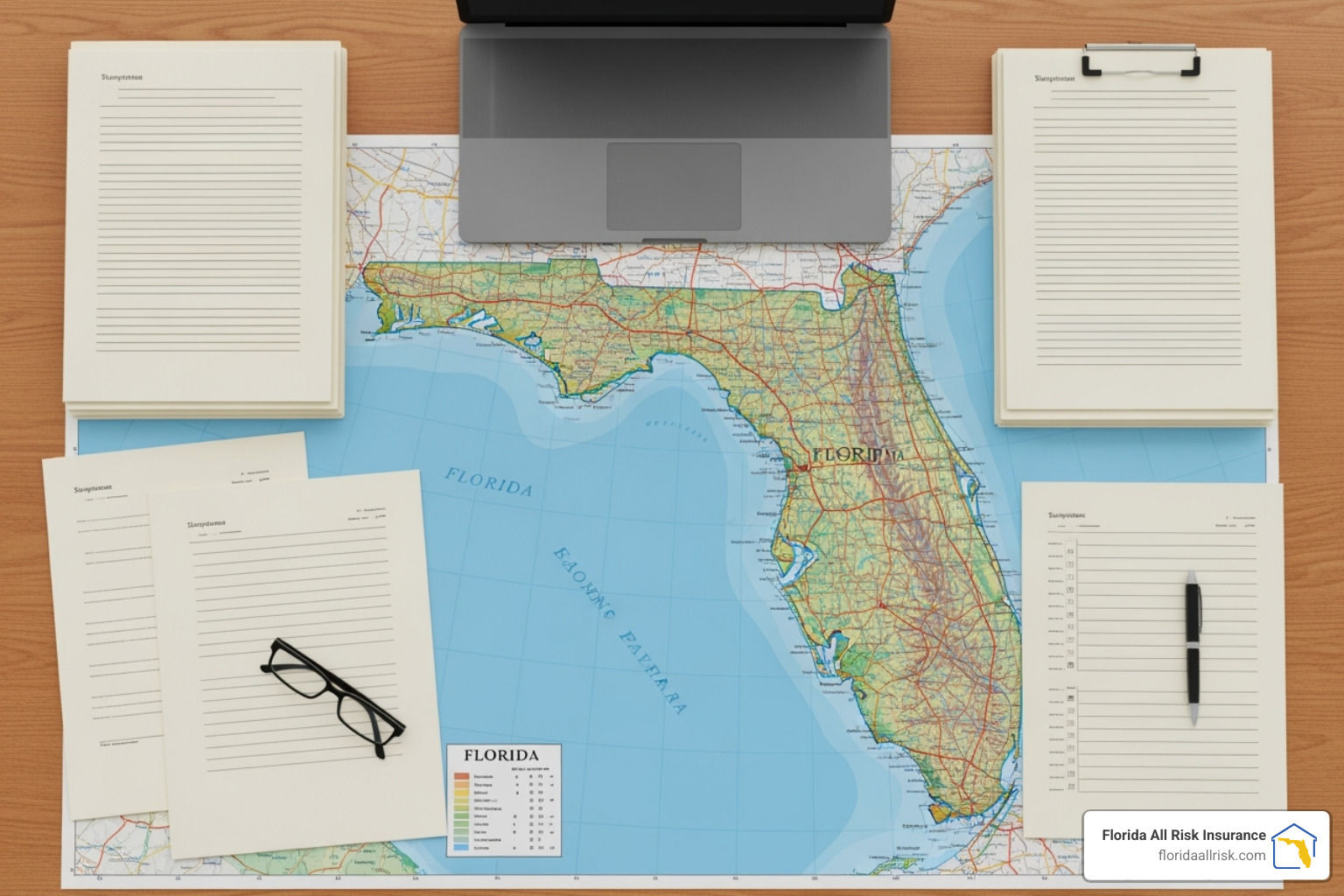
Navigating florida flood insurance rate maps, insurance policies, and mitigation can feel overwhelming. However, there is a wealth of official information and expert assistance available to help you make informed decisions and protect your property.
Key Contacts and Official Websites
For the most reliable, accurate, and up-to-date information, it is always best to go directly to the primary sources. Bookmark these essential websites:
- FEMA Flood Map Service Center (MSC): As detailed earlier, this is the official federal portal for viewing, downloading, and printing current and historic flood maps for any community in the United States.
- FloodSmart.gov: This is the official consumer-facing website of the National Flood Insurance Program (NFIP). It offers comprehensive, easy-to-understand information on flood risk, insurance coverage options, finding an agent, and filing a claim.
- Florida Division of Emergency Management (FDEM): The FDEM is the state’s lead agency for emergency preparedness and response. Their website provides Florida-specific guidance on hurricane preparedness, flood mitigation grants, and state-level floodplain management initiatives.
- Your Local Floodplain Administrator: This expert, located in your city or county building or planning department, is your go-to resource for questions about local building codes, permit requirements for mitigation projects, and information about upcoming map changes in your specific community.
- FEMA Mapping and Insurance eXchange (FMIX): If you have a highly technical or specific question about a flood map or an insurance rule, the FMIX provides direct assistance from FEMA map and insurance specialists via phone and online chat.
Understanding Elevation Certificates (EC)
An Elevation Certificate is a vital document that provides property-specific elevation data. It is not a simple estimate; it is a detailed report prepared and certified by a licensed land surveyor, engineer, or architect. The EC records the elevation of your home’s lowest floor, lowest adjacent grade, and highest adjacent grade relative to the Base Flood Elevation (BFE). This precise data is used by insurance agents to accurately rate your flood insurance policy. A favorable EC—one that shows your home’s lowest floor is well above the BFE—can result in significantly lower premiums by demonstrating a lower risk profile.
An EC is often required for new construction in an SFHA, for documenting compliance after a substantial improvement, or as the primary evidence when applying for a LOMA to challenge your florida flood insurance rate map designation. Before paying for a new one, check with your local floodplain administrator; they may have an EC on file from when the home was built. Some tech-forward counties, like Lee County, even allow you to Search for an elevation certificate online.
Conclusion: Take Control of Your Florida Flood Risk
Understanding your florida flood insurance rate map is the fundamental first step in protecting your most valuable asset in our beautiful but flood-prone state. Throughout this guide, we have seen how these essential FEMA maps are not just lines on paper, but powerful tools that define flood risk, shape community development, and directly influence your financial obligations through building codes and insurance requirements. Knowing your flood zone—and what it truly means—empowers you to move from uncertainty to action.
While the information can seem complex, the path forward is clear. You have the ability to verify your risk using official tools, challenge a designation if you believe it’s incorrect, and most importantly, implement smart mitigation strategies that can drastically reduce your vulnerability and lower your insurance costs. In Florida’s ever-changing coastal and inland environment, where storms are becoming more frequent and intense, proactive vigilance is not just wise—it’s essential for long-term security.
Don’t leave the safety of your home and family to chance. At Florida All Risk Insurance, we specialize in helping Floridians steer the unique insurance landscape and the specific nuances of flood maps and policies. We can help you find the right coverage to ensure you are protected.
Get a Flood Insurance Quote today, and let our experts help you secure the peace of mind that comes from knowing you are prepared for whatever the weather brings. Protect what you’ve worked so hard to build.
Contact Us
Florida All Risk Insurance
Address: Saint Petersburg, FL
Phone: (727) 202-4299
Email: [email protected]